
You searched for
See & do
-
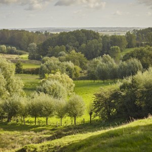
Nature reserve Scherpenberg
The landscape on the 125-metre high Scherpenberg hill consists of fontinal woods, wet spring meadows, sloping pasture, and dry arable land. This protected landscape is interspersed with hedgerows,...
-
Provincial Domain Kemmelberg
The purchase in 1995 of 21 hectares of woodland on the summit of the Kemmelberg (Mount Kemmel) marked the first step in the creation of a new provincial domain. In the following years, the...
-
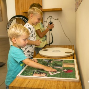
Visitors Centre 'Het Heuvelland'
Start your visit to Heuvelland in the child-friendly visitors' centre, where the landscape surrounding Mount Kemmel is explained. A wide selection of evocative images and tailor-made tourist...
Do
-
Forgotten Traces
The landscape, where past and present meet, is a silent witness to the events that occured. Cyclists can follow in the path of American troops during the First World War. Many of them were killed...
-

Cycling route 'Mine Battle' 14 - 18
The Battle of Messines mining route takes you to all the locations where, on 7 June 1917 at 4:10 a.m. (“Zero Hour”), the Allies detonated 19 deep mines simultaneously. The massive explosions...
-
Frontmap Wars without End
This map of the old front region - ‘Wars Without End’ - gives a summary of all the heritage sites in our landscape that are associated with the First World War, the Second World War and the Cold...
-
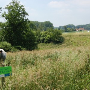
Scherpenberg nature reserve
The landscape on the 125-metre high Scherpenberg hill consists of fontinal woods, wet spring meadows, sloping pasture, and dry arable land. This protected landscape is interspersed with hedgerows,...
-
Cycling network map Westhoek
We cycle between vineyards and tranquil, green spaces, between hills and picturesque villages, between traditional brown cafes and lively meeting places.De Heuvelland cycle route is both an...
-

The Silence Path
Do you want to escape from the hustle and bustle of everyday life, to leave behind the non-stop flood of e-mails and text messages, to hit the pause button and just be yourself, even if only for a...
-

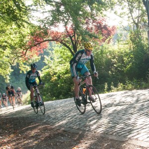
Cycle Route 'Gent-Wevelgem Challenge'
The course of Gent-Wevelgem in Flanders Fields conquers the main slopes of the cycling classic 'Gent-Wevelgem'. On the programme: 56 kilometres of suffering, 3 infamous plugstreets (semi-hardened...
-
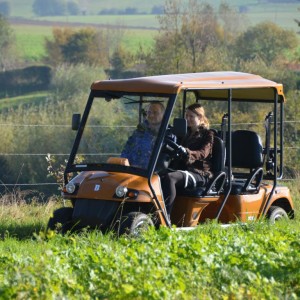
Golfkar Westhoek
Looking for a unique way to explore Heuvelland and its surroundings? Hire an electric golf cart with GPS and route book to enjoy beautiful views, nice spots and sights. The carts are whisper quiet,...
-

A stone's throw from Heuvelland
Heuvelland is a perfect – and peaceful – base for exploring the wider Westhoek region and northern France. The Heuvelland map gives you an overview of our region and the roads to neighboring...
-
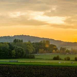
Cense de l' Alouette
The name 'Cense de l'Alouette' appeared on the Ferraris maps of 1771. The ridge is part of the Tielt Formation, a dune mound that was formed around 50 million years ago. Lying in the shadow of the...
-

Heuvelland Map
The Heuvelland map gives you an overview of our region and the roads to neighboring municipalities. It also shows all the main sites of interest, vineyards, hills, public woods, etc.
-

VDB route - 76 km
This 76 km trajectory is a tribute to the late Frank Vandenbroucke and follows his favourite training route through the rolling landscape of Heuvelland.
-
Visitors Centre 'Het Heuvelland'
Start your visit to Heuvelland in the child-friendly visitors' centre, where the landscape surrounding Mount Kemmel is explained. A wide selection of evocative images and tailor-made tourist...
-

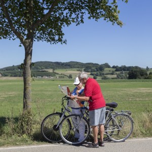
Heuvelland cycle route
Take a bike ride with your loved one, friends or family and discover the green and cultural treasures of West Flanders. This route is perfect for a day out. Enjoy the landscape of Heuvelland and...
-
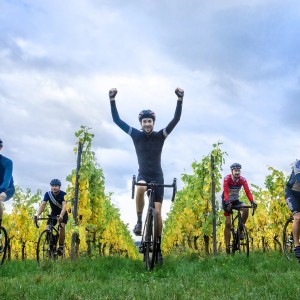
Sports Cycling in Heuvelland
In the otherwise flat landscape of the beautiful Westhoek, the hills of Heuvelland quite literally stand out. The Kemmelberg is perhaps the best known, but several others also offer a serious...
-

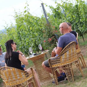
Heuvelland Vintage Cycling Route
The Heuvelland Vintage Cycling Route takes you along ten wineries. Waymarks, in the shape of wine bottles, provide information about each place. The wine can be sampled at the wineries or in local...
-
Hill Route - 116 km
You are a practiced cyclist and are looking for an tough training challenge? We can offer you three great - and very hilly - alternatives. The Heuvelland Hill Route will take you up and down 40...
Food & Drinks
-
Cense de l' Alouette
The name 'Cense de l'Alouette' appeared on the Ferraris maps of 1771. The ridge is part of the Tielt Formation, a dune mound that was formed around 50 million years ago. Lying in the shadow of the...
-
Visitors Centre 'Het Heuvelland'
Start your visit to Heuvelland in the child-friendly visitors' centre, where the landscape surrounding Mount Kemmel is explained. A wide selection of evocative images and tailor-made tourist...
-

Short Chain Map
If you buy our local specialities directly from the producers, you will be buying super-fresh, super-healthy and super-delicious products at their very best. The Short Chain map will allow you to...
News
-

Unesco World Heritage
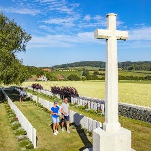
The French ossuary (mass grave) on Kemmel hill and the moving Spanbroekmolen and Lone Tree Cemeteries in Wijtschate: discover Heuvelland’s most recent UNESCO World Heritage sites.
Read more